
Description
Waterproof Charts 22 Tampa Bay Navigation
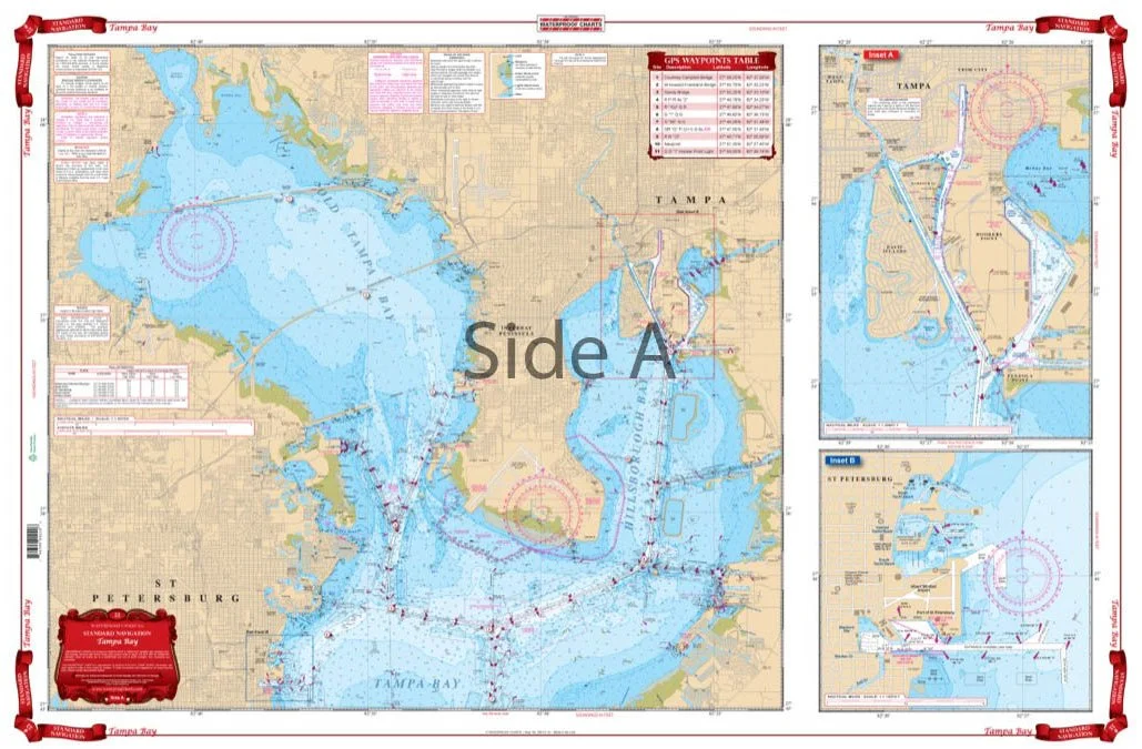
Best detailed coverage for both North and South Tampa Bay and to 10 miles offshore. Includes Manatee River to Interstate 75 Bridge as well as Boca Ciega Bay. Includes Old Tampa Bay. Has blown up detailed insets for St. Petersburg and Davis Island and Hookers Point. This Tampa Bay nautical chart is going to become your best friend while you’re on the water. Whether you’re in a kayak, on a paddleboard, or boating, your Waterproof Chart will stand up to the elements. We offer the best detailed coverage for both North and South Tampa Bay and to 10 miles offshore. This is because we take data from 2 NOAA charts to make sure you have the most detail possible. This nautical map also includes Manatee River to Interstate 75 Bridge as well as Boca Ciega Bay and Old Tampa Bay. You’ll find convenient, blown up detailed insets for St. Petersburg and Davis Island and Hookers Point. We recommend you get two of these marine charts. We know you’re wondering why. One for the boat, and one to frame on your wall because you’ll love this navigation chart so much. Information from 2 NOAA Charts: #11414 and #11413. Nautical chart is 25″ X 38″. WGS84 – World Mercator Datum.
- Waterproof Charts 22 Tampa Bay
- Standard navigation
- Manufactured in United States
Reviews
There are no reviews yet.